Date Climbed:
Peak: Mount Tyndall (14018')
Route: North Rib- Class 3
Gear- Helmet
This time around Scott and I wanted to climb something a bit more difficult than Mt. Sill. We decided the east face of Mt. Tyndall would be the best option considering permit issues. We invited our buddy Jerin to come along with us. We left Orange County pretty late Thursday night and drove up toward Horseshoe Meadow near Mt. Langley to bivy and acclimatize. The next morning we rushed down the the ranger station and made it just in time for the days permit lottery. There were 20 groups fighting for permits throughout the Sierras just at that station. We drew 16th, so we were worried that we would not get a permit. Not surprisingly most of the people were there for mount Whitney and we had no problem obtaining a permit for Shepard Pass.
From the ranger station in Lone Pine we went and got breakfast in town. I had really greasy corned beef hash that definitely helped my energy levels. After breakfast we drove to Independence and then on to the trailhead. The description of the route to the trailhead said 4wd and no stock vehicles, but we went for it and had no problems in the Subaru. The trailhead was pretty low, being around 6300' and it was hot.
We started on the trail around noon.
 |
| Jerin starting the trail |
We had to cross the creek a few times but there were stones to step on. At the third crossing we decided to drink some water and refill our bottles cause we knew there was gonna be a long dry stretch ahead. Jerin pulled out his Steripen to sterilize our water but it wasn't working. Turns out he has never charged it. We determined that the steep canyon above meant that the stream was probably sourced from a stream and we knew that there was no trail or people up above so we took our chances and drank the water. We all turned out fine. After filling our water and a quick stretch we set off back up the trail. What proceeded next can only be described as the switchbacks from hell. I've never seen the notorious switchbacks on Mt. Whitney, but I'm pretty sure these were taller and longer. They were 3 miles long and almost 2800ft of elevation gain. We took another short break at the top of the ridge and proceeded back down the other side about 700 vertical feet. The convoluted trail.
 |
| Far up the canyon looking toward Owen's Valley |
 |
| Jerin and Scott takin a break at the top of the ridge |
After we bottomed out again it was another 2000 vertical feet and a few miles to our camp. We were
going to try and make it to Shepard Pass, but we were getting tired and it was getting dark so we decided to camp just above Anvil Camp and 10400'. The next morning we woke up early and started back up the trail and made it to Shepard Pass a few hours later.
 |
| Peak just north of Shepard Pass |
 |
| Steep gully to Shepard Pass |

 |
| Toward King's Canyon and Sequoia NPs |
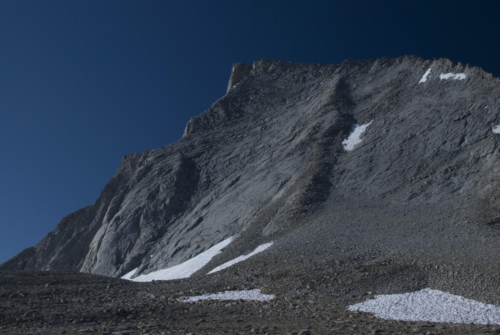
 |
| First view of Tyndall's North Rib |
 |
| Jerin working his way up Williamson |
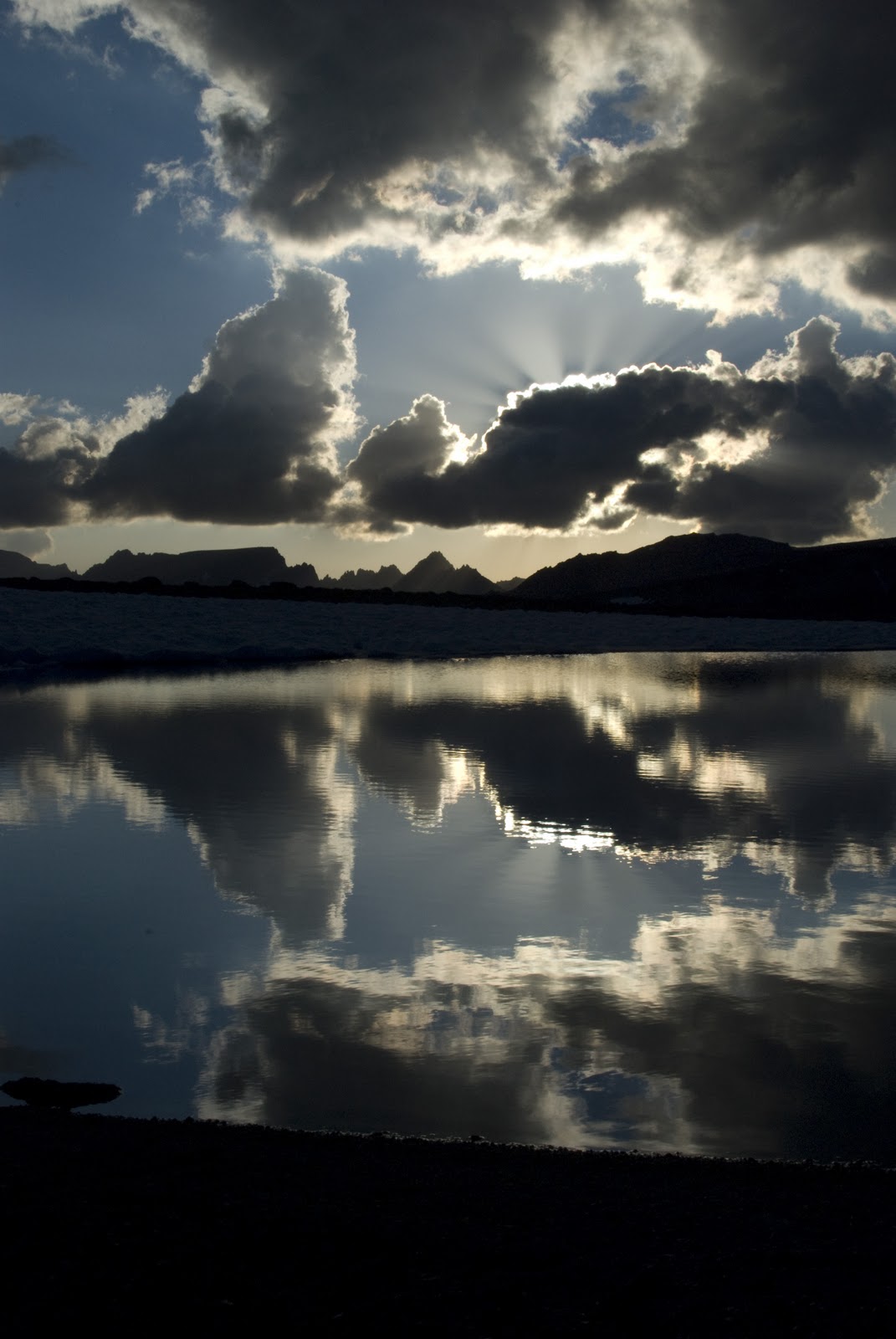
Because of our impromptu night at lower elevation we decided to try and climb Mt. Williamson instead of spending the day doing nothing. We tossed down our heavy things and just took some water and food in a day pack to try and climb Williamson. The approach to Williamson was rough and long, it took almost an hour. We were also extremely unsure of the route up the mountain, I had seen pictures of the route before but it all looked the same. We decided to pic a gully that we could see exited at a high ridge. Scott and Jerin were hit hard by altitude sickness and were unsure whether they would continue. I decided to keep going looking back every once in a while to see if they were following. I made it to the ridge and was met with a maze of ledges and rocky outcrops and no clear way to the summit. I looked it over for a few minutes and decided on a route. It turned out to be very sketchy and really dangerous without a rope. There was dirt on every ledge and a lot of the handholds were loose. There were a few instances where had to downclimb and find another route. I finally made it to the ridge proper just as Jerin and Scott were starting up. I quickly saw that we were screwed. on the ridge I was surrounded by shear cliffs and a super exposed slabby wall that I did not feel comfortable climbing without a rope. It was getting late and I had a few too many scares to find another way up so we retreated. I only had 2 liters of water that day cause thats all I could carry and since we couldn't purify anymore during the day without boiling it, I was getting very dehydrated by the time we were heading back to camp. The other problem was that we had not brought enough fuel to purify water and cook food. Luckily on my hike back to camp I befriended a few hikers and they offered to let us use their water filter. They probably saved our live or at least our trip. After making dinner we were greeted by an amazing sunset at our 12000' camp site.
 |
| Awesome sunset over alpine tarn |
 |
| Sunset light on Tyndall |
 |
| Last dying bit of light |
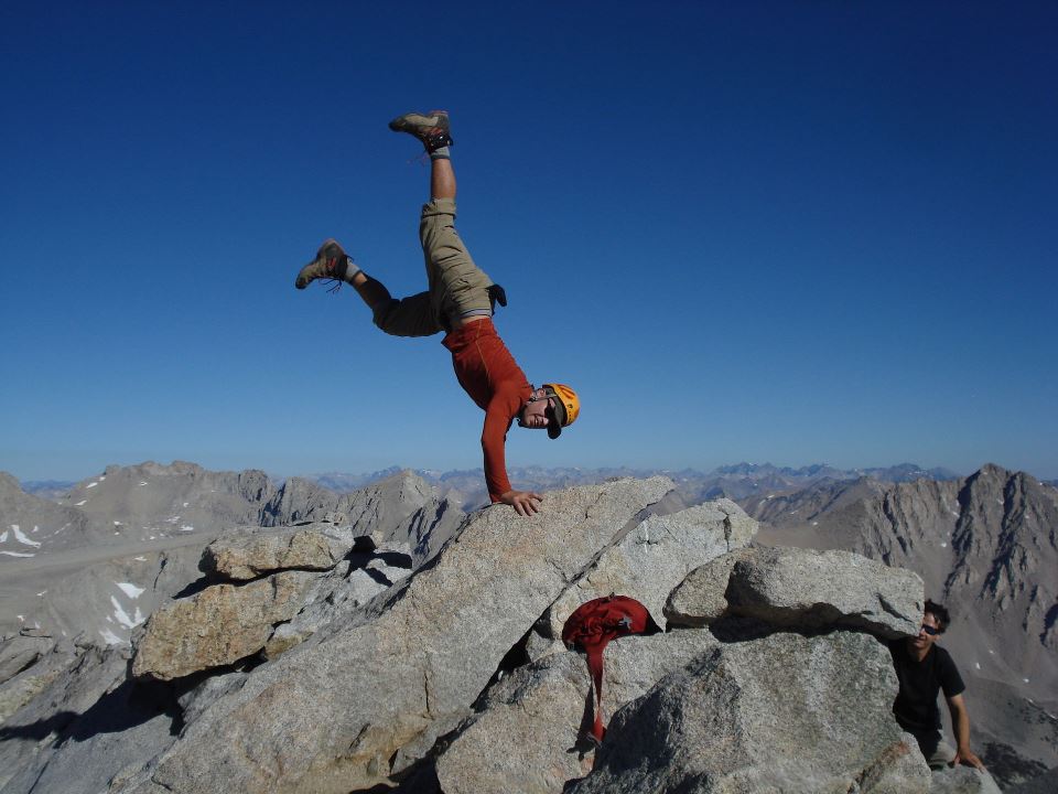
That night I went to bed relatively warm but woke up around 2am absolutely freezing. Apparently the temp got to 25 degrees and I had brought a 35 degree sleeping bag that probably had a comfort rating more like 40. Needless to say I would slip in and out of sleep and shiver while I was awake. At one point it got so bad I almost decided to get up and climb Mt. Tyndall in the dark just to get some warmth. We woke up at 6 and set off at about 7. The climb up Tyndall was originally supposed to be an all day sufferfest up the east face. But after the failed attempt on Williamson and Scott and Jerin's continuing altitude sickness we decided to do the easier North Rib route. It actually ended up taking use a mere hour to climb the route, but it was super fun. we spent a short time on the summit and headed back to camp and packed up.
 |
| Crumbling summit block |
 |
| Scott on top of Tyndall |
 |
| Me on top |
 |
| Jerin is braver than me |
We hiked out in 4 hours.
 |
| Mount Williamson on the way out |